Dubai is a city with a huge number of attractions and places that are definitely worth visiting during your trip. But this city is very large, and a new tourist may find moving and traveling around Dubai problematic. In today’s article we will tell you how to navigate the city correctly, what transport to use and how to easily travel around Dubai.
Best Transport To choose
First, let’s decide on the mode of transport. Although Dubai has a well-developed public transport system, including metro, buses and even a monorail, we still recommend renting a car. A rental car will allow you to save a lot of time on transfers and will allow you to get to even the most remote parts of the city, where regular tourist buses do not reach. Renting a car in Dubai couldn’t be easier. In general, the UAE has an excellent car rental service, so it will not be difficult for you to rent a Mercedes in Dubai or abu dhabi BMW. From hundreds of car rentals, you can always choose the one that suits you and your family.
Terrain Orientation
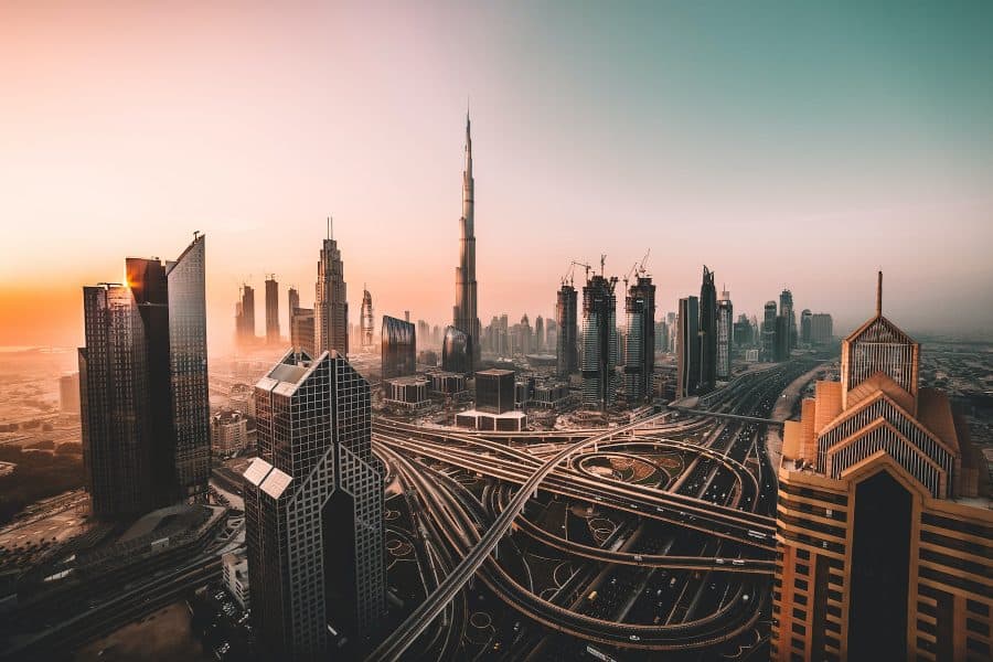
The city of Dubai stretches along the coast of the Persian Gulf for 70 km. The width of urban areas ranges from 20 to 35 km. There are two main highways stretching across Dubai: one, Jumeirah Street, along the coast, the other, Sheikh Zayed Rd, almost parallel to the first, at some distance from the coast.
These highways leave practically from one point in the Dubai Marina area, and then diverge over a distance of 2 km.
Freeway Along The Coast
Coming from Dubai Marina, the coastal highway takes the name King Salman Bin Abdulaziz Al Saud Street, and after Madinat it becomes Jumeirah Street. Has 6 stripes. Buses and trams run along it. The tram is of local importance: it loops around the elite Dubai Marina quarter and goes east to Al Sufouh Beach.
From the tram it is convenient to transfer to the monorail towards Palm Jumeirah and the Atlantis Hotel (get off the tram at the Palm Jumeirah1 stop and walk 450 meters to the monorail).
Bus Number 8
The most popular transport running along the entire coastline is bus No. 8. Its route stretches from Ibn Battuta metro station in the west to Gold Souk Bus Station in the east of Dubai. The entire journey takes 95 minutes. Bus number 8 runs from 5 am to 9 pm every 20-30 minutes.
The bus route ends on the eastern bank of the Creek Canal, in the Deira area, at the Gold Souk Bus Station, next to the Palm Deira MRT station. In the Deira area you can visit the Gold, Spice, Perfume and Fish markets.
You can take bus number 8 from the following metro stations: Ibn Battuta, DMCC, Damac Properties, Al Ghubaiba and Palm Deira.
Sheikh Zayed Road
Sheikh Zayed Road (Sheikh Zayed Avenue) is the main city thoroughfare. It has 16 lanes, and the red metro line runs along it.
The metro in Dubai is mostly above ground, so you can get some impression of Dubai while traveling on the metro. Especially if you take a gold card, which allows you to take a seat in the first carriage (superior comfort) and stand at the front window (in the Dubai metro, the carriages go without a driver, the front window is panoramic).
Taxi
Taxis are in high demand in Dubai. They are inexpensive, convenient to use, and easy to catch on the street. There are special taxi stands in shopping centers. When boarding, you must choose official RTA taxis (with a colored roof), which operate on a meter.
Conclusion
These are the main roads and modes of transport that will allow you to move around without problems. In general, traveling around Dubai will not be difficult to navigate around the city. The main thing is to plan your trip in advance and create a route.